Shared & Smart cities Implementation Strategy & Data analysis
Bachelors Minor | 2020
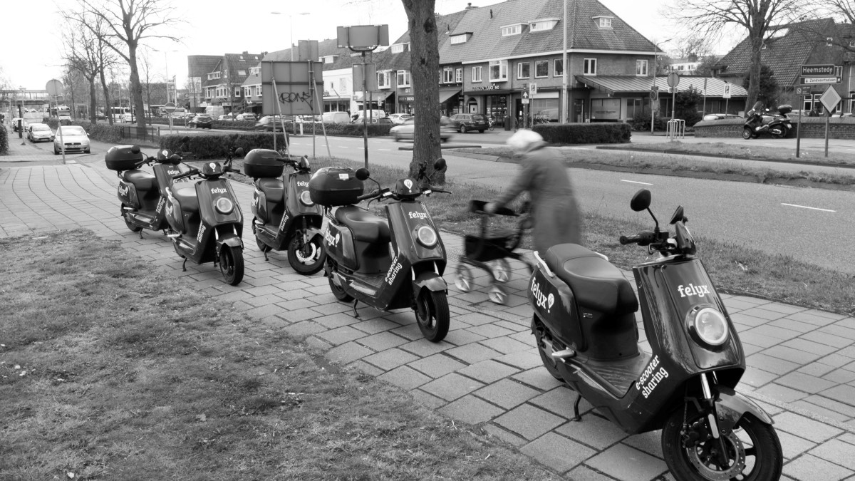
How can we tackle wrongly parked shared scooters?
With the use of open-sourced data and mobile generated data from shared-scooter services, we have created an effective way to allocate adequate parking areas for shared scooters services.
Project aim: Creating a strategy for the City of The Hague to prevent wrongly parked shared scooters.
Result: A simple yet effective implementation strategy (based on open-sourced and mobile-generated data) for cities and municipalities to allocate appropriate parking areas and prevent pedestrian pathways congestion.
Keywords: Implementation strategy, user research, data analysis, open-sourced data, mobile-generated data, context research, shared scooter services, public sector.
Active areas of shared scooter services
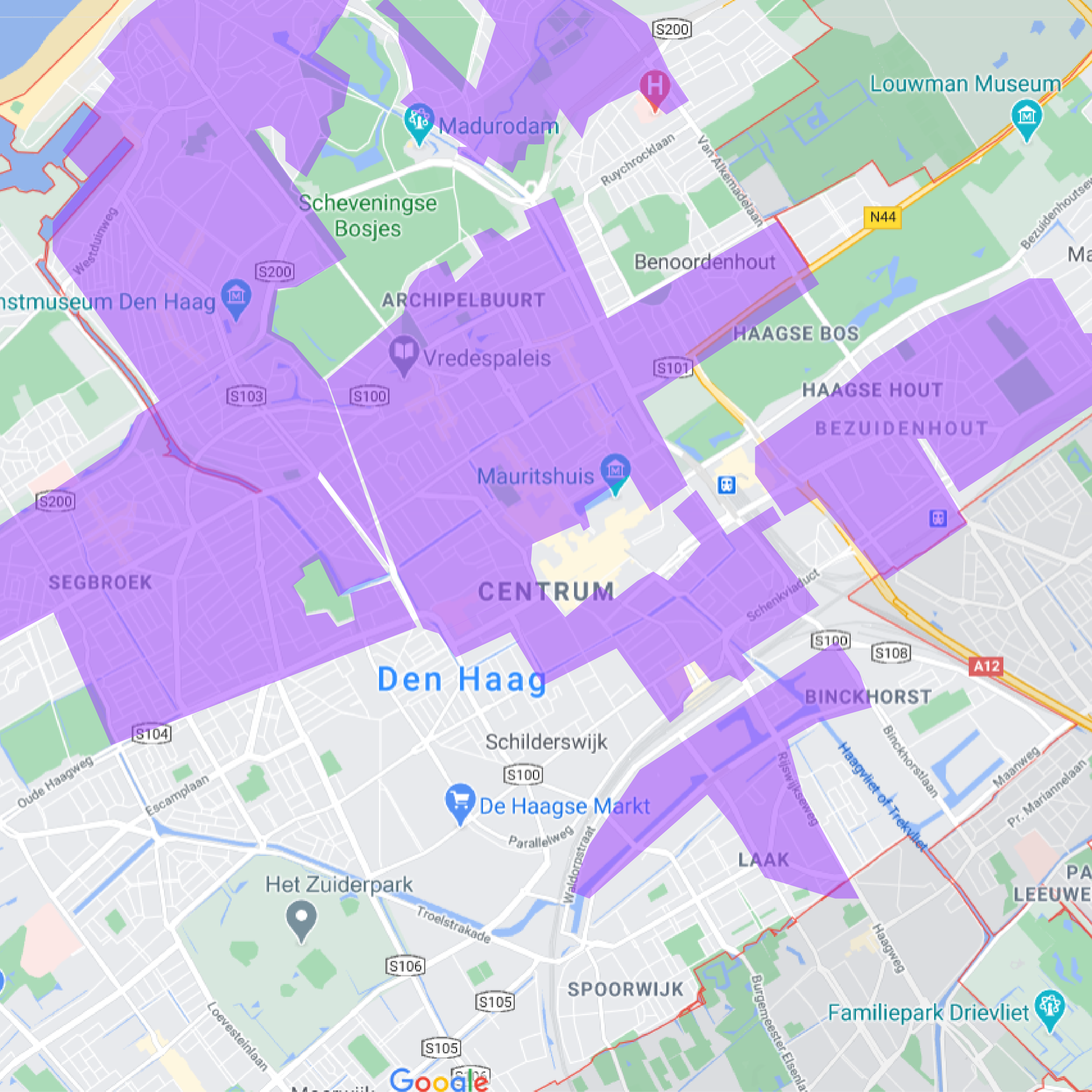
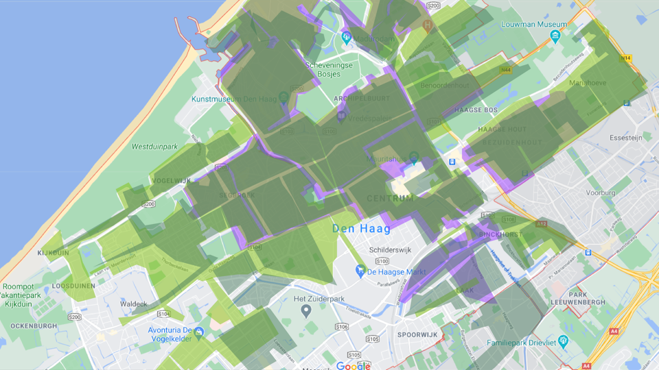
Total active area of shared scooters in The Hague
To understand the area of where wrongly parked scooters can be placed we have overlapped the active areas of all the shared scooter services in The Hague. Based on how the Check, GO and Felyx applications are set up, users of these services cannot end their rentals outside of these areas.
This overview creates a clear indication of activity of shared scooters, that mainly occurs in the north of the Hague and in the city centre.
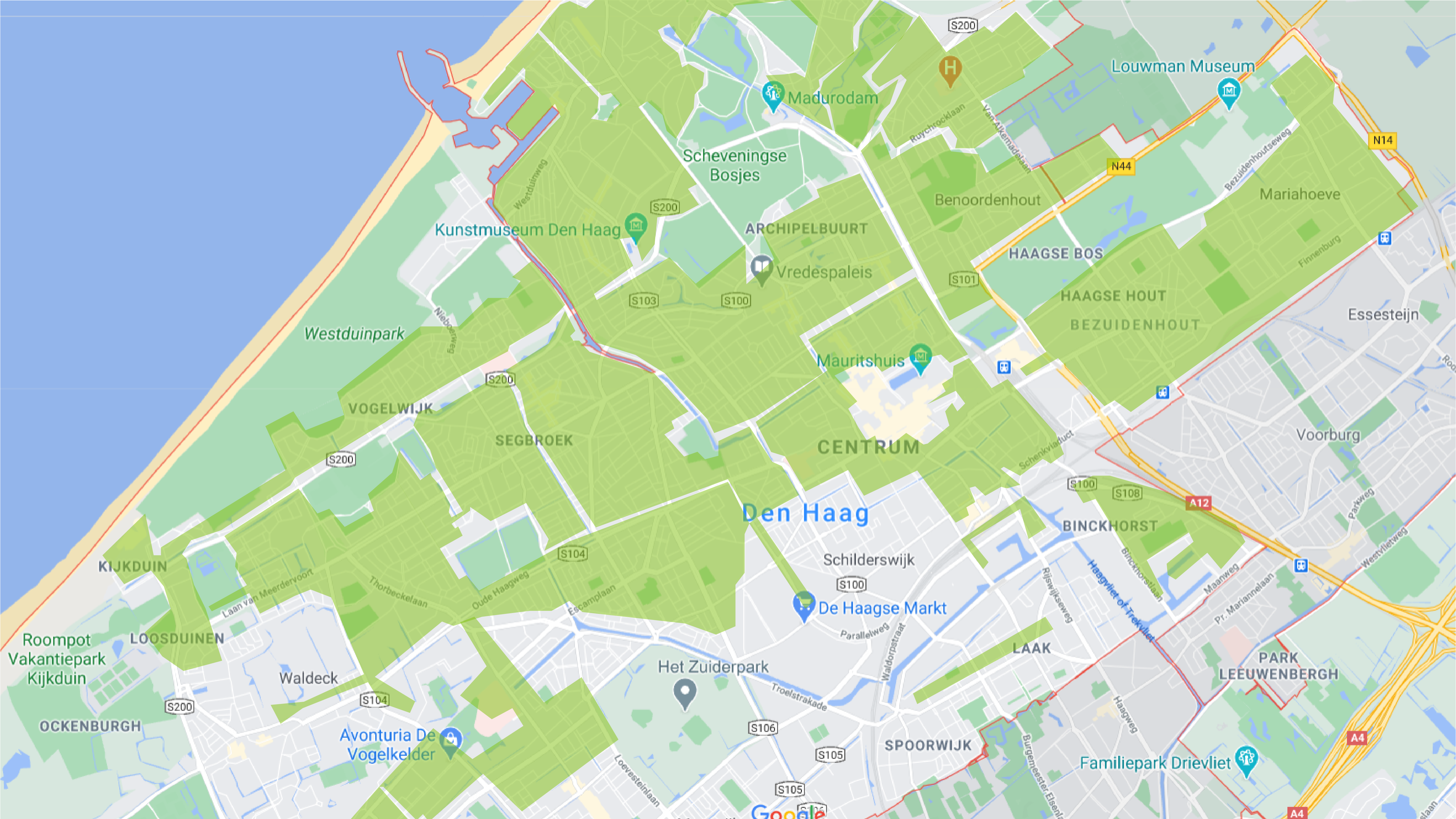
Identifying hotspots
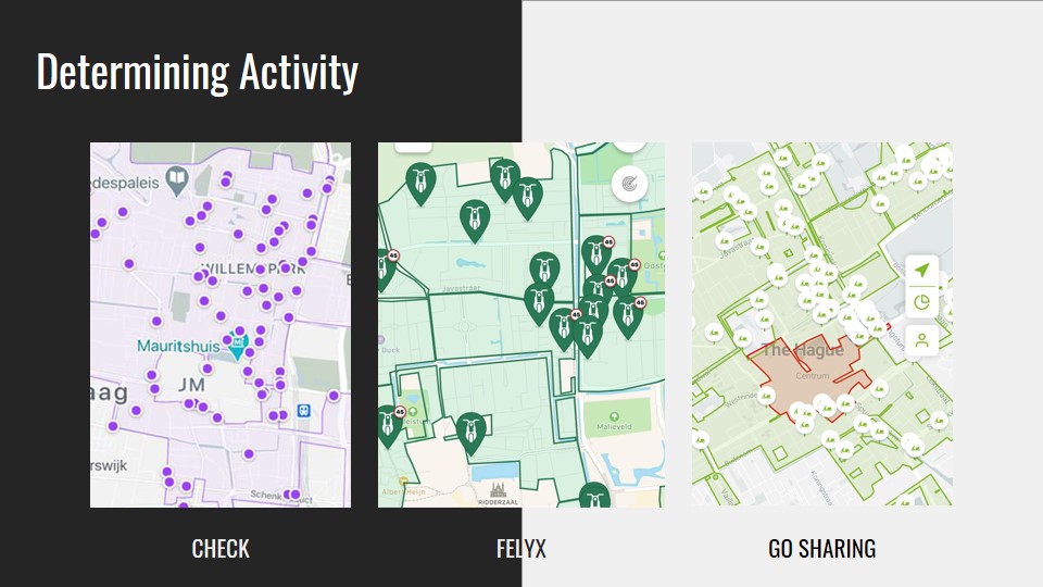
High activity areas
Each shared scooter service showcases real-time parked scooters. By analyzing the data from these apps, and overlapping the active areas of all the scooter services we can identify certain hotspots in the City of The Hague. This gives us an overview to see which regions are more active than other regions. The overview and combination of analyses converges our focus to certain areas in the city centre that needs more parking spaces.
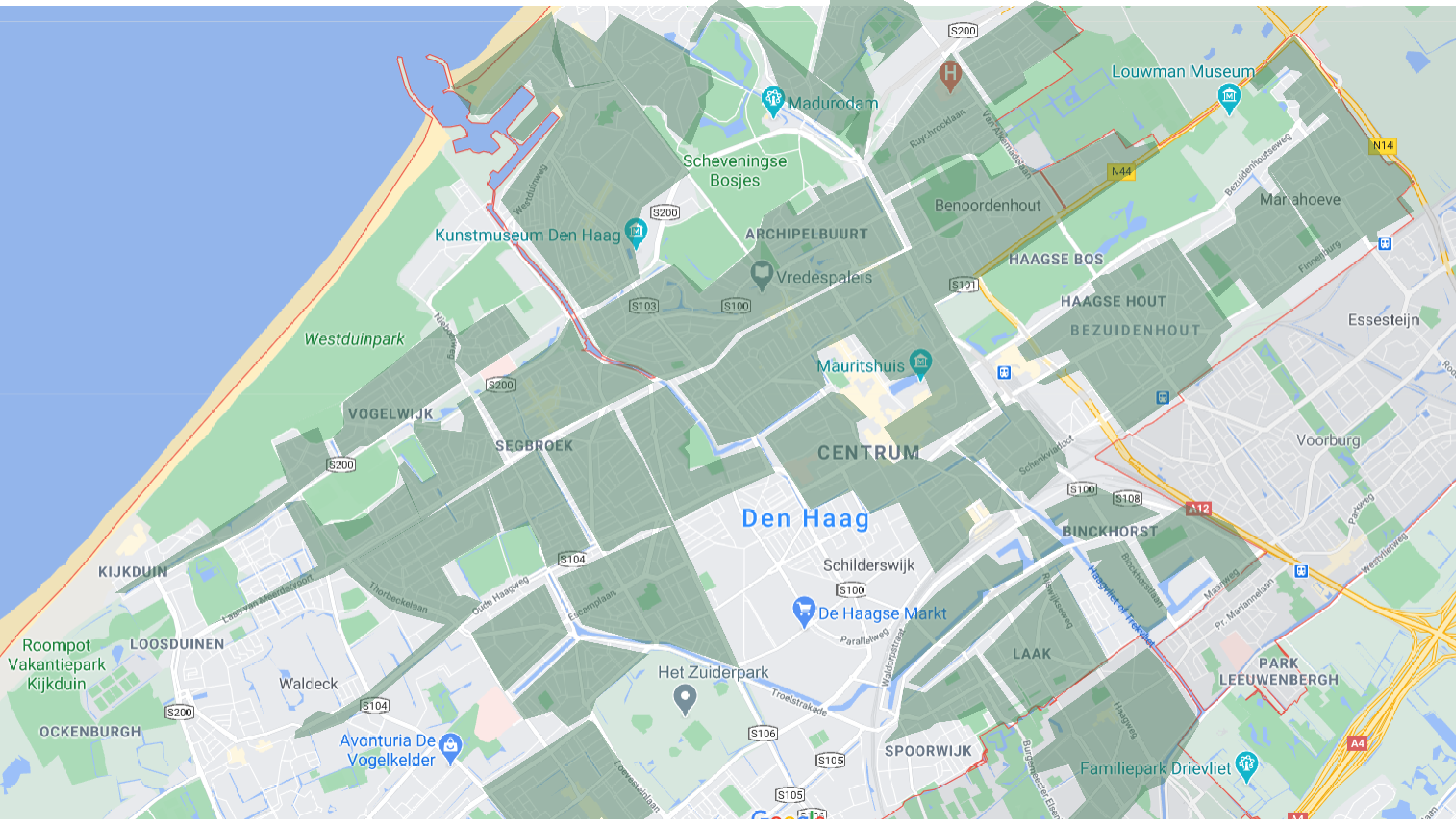
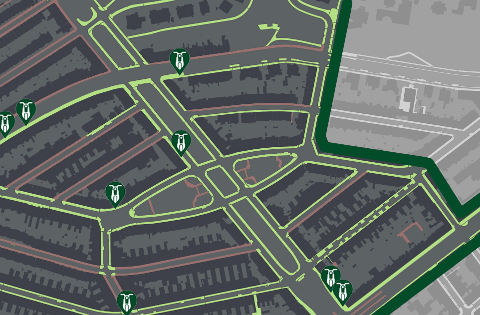
Finding adequate parking areas
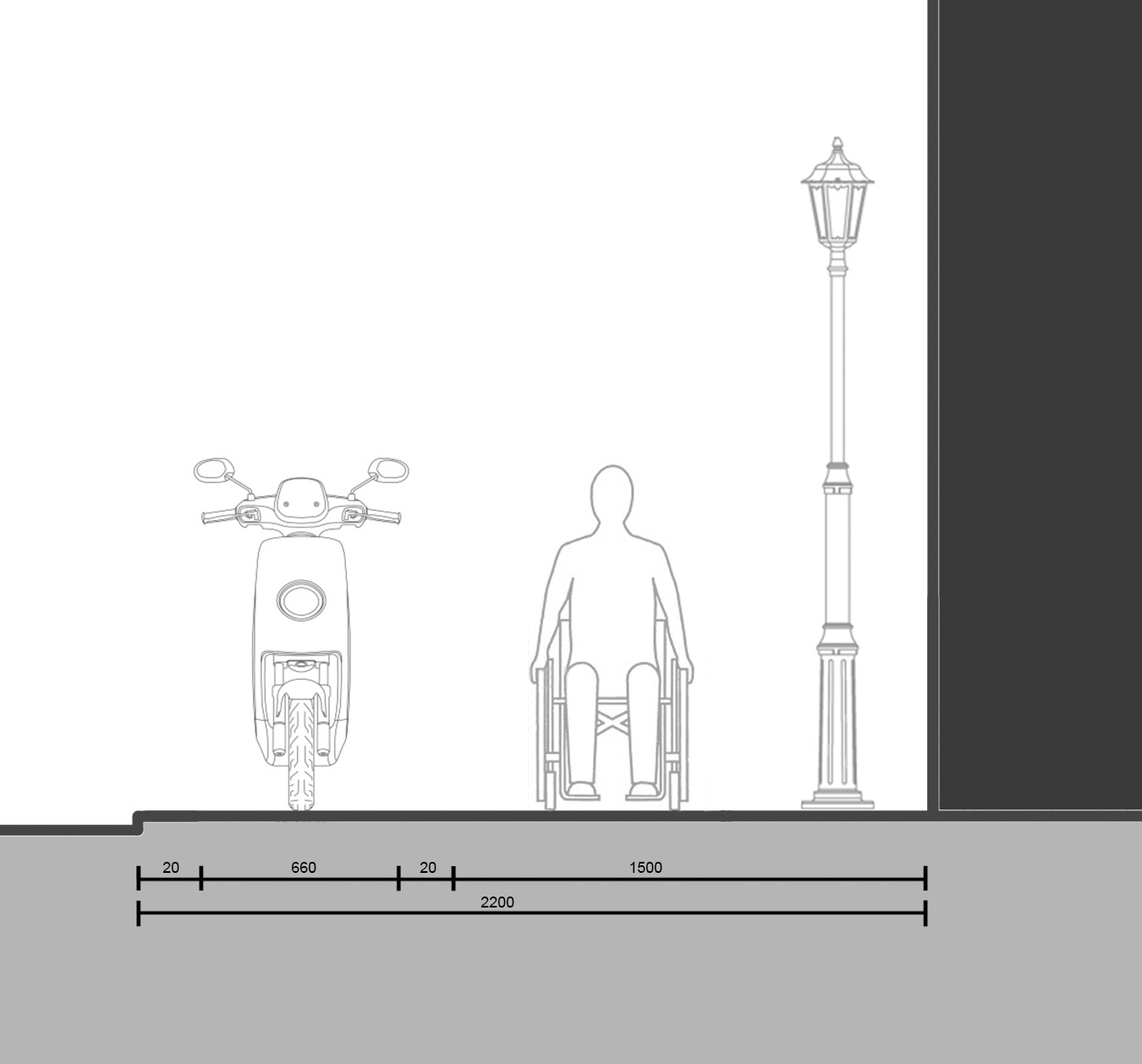

Open-data sources
& data tools
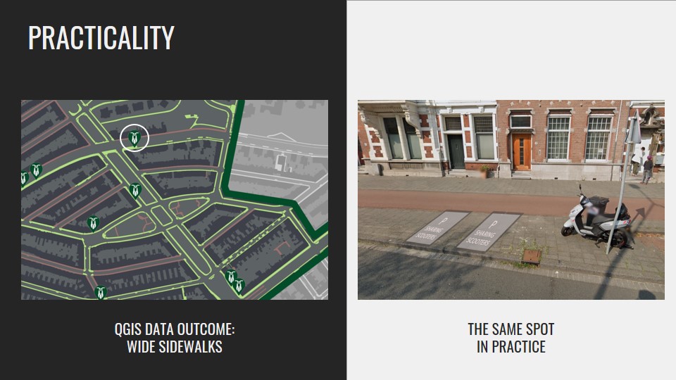
This project uses various data tools to analyze and find adequate parking spaces for shared scooters. With open-sourced data (from BGT viewer and PDOK) we can locate spaces and sidewalks with adequate spacing for scooters to be parked and not be hindered by people in The Hague.
The proposed strategy combines the use of QGIS and open source datasets, and would be beneficial for city planners, public sector and shared scooter services to create opportunities in integrating appropriate parking areas and carefully adjusted active areas in cities. In this way the users’ are better informed on where and how to park the vehicles, thus successfully preventing pedestrian pathways congestion.
